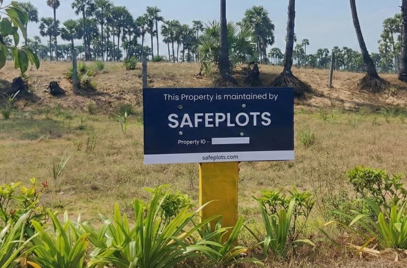
ID Board Installation
We install high-visibility ID boards on your plot. These rugged, weather-proof signage boards deter land grabbers & trespassers.
- ✓ Weather-Proof: Durable materials that withstand harsh conditions.
- ✓ Legal Disclaimers: legal warnings can be included on request to deter potential encroachers.
- ✓ Ownership Records: Official ownership records can be included on request for added authenticity.